
Laasna ots
Laasna ots & Shingle Beach
Exposed to storm wavesWe have reached a point of land with large stones called Laasna ots. The name probably comes from the word "laastama" (to ravage/devastate). Wind, sea waves, and ice all do their destructive work here. To the southeast opens a view of Vesiotsa Bay, the farm complex, and Kasemets.
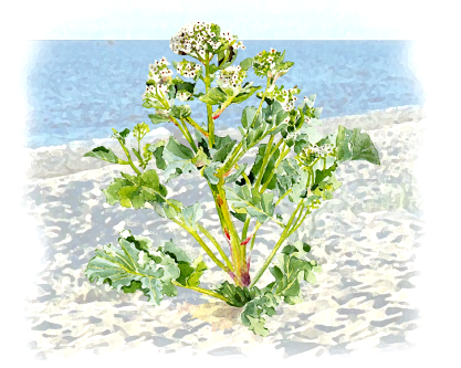
A shingle beach is characteristic of Saarnaki's western coast, because it is sufficiently exposed to storm waves. Here the rock material is coarser towards the land than towards the sea, which is due to the fact that stones are piled furthest and highest during strong storms. As depth decreases, short and fast water currents directed towards the beach catch stones and roll them up the slope. The retreating water flow is slower, and despite gravity, the stones do not roll back to their original position, but get stuck halfway. Thus, stones move further towards the shore over time, making the coastal ridge constantly change.
Ice Action & Coastal Uplift
Ice mounds up to 4 m
In winter, the ice cover hinders the action of the waves, but when melting, the ice mass pushing onto the beach with strong winds piles up here into ice mounds up to 4 m high. On the seabed, ice floes can also reach depths of several meters, loosening near-shore seabed sediments and pushing out large erratic boulders. The large stones of Laasna ots are also presumed to be the result of ice activity. Pushing deep inland in places, ice also severely batters coastal junipers, which appear to flee from the sea, but unfortunately their roots cannot keep up.
Among the factors shaping the coast, the uplift of the land surface is also important, which in Western Estonia is 2–3 mm per year.